Showing posts with label Buena Vista. Show all posts

Tuesday, July 22, 2025

Mt. Hope and Quail Mountain - July, 2025


Brad, Tim and I set out in my manly minivan to a trailhead that didn't require 4 wheel drive to camp out the night before a more strenuous hike up Centennial 13er Mt. Hope and neighbor Quail Mountain.  When we got there, Tim realized he forgot all of his sleeping gear.  Fortunately, I brought enough extra gear including extra foam pads, extra pillow, and an extra sleeping bag, all of which I was intending to use for myself.  So I shared these items with him, but it didn't really matter as sleeping in a tent is not usually very effective anyway.  

We woke at 4:00 am as we knew weather was looking rainy.  We hoped to beat the weather at least while we were above tree-line for safety.  This trail from sheep gulch is relentlessly uphill.  We moved at a steady pace conserving our energy knowing we had almost 5,000 feet of elevation gain today.  We reached treelike just as the sun was rising with stunning views over neighboring 14ers Mt. Belford and Huron peak.  

Mount Belford Sunrise - Prints available


Huron Peak

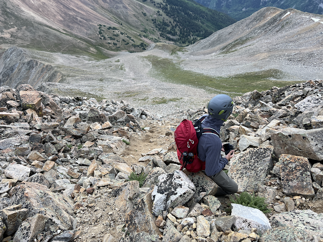
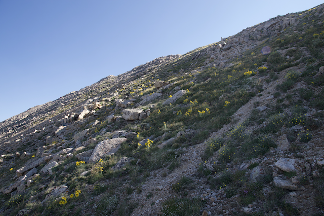
We reached Hope Pass and surveyed the route up Mt. Hope.  Route descriptions I had read made it sound like most of the route up was on tundra until the top where there was a bit of scrambling.  This was inaccurate as the terrain was a mix of steep gravel and loose rock for a majority of the climb and slowed us down a bit.  There were a few fun sections, but overall a tad unpleasant. The way down required a bit of route finding, and we had to backtrack a couple times before getting into steeper sections. In general, staying closer to the ridge as much as possible is advisable. 


La Plata Peak from the summit

Mt. Elbert

Twin Lakes

Once back down to the saddle, we felt good and the weather was cooperating nicely so we had a good workout up the steep trail to Quail mountain.  There are some cool mining ruins up there.  While we sat eating second breakfast, a few ptarmigan started harassing us for no apparent reason.  maybe they had some little ones nearby where we were sitting?  They are some beautiful but loud little boogers!


Ruins with Missouri Mountain (center) Belford (left of center) and Harvard (far left)


Fighting over who gets the hiking polls on the way down

This one was overal a great choice for a day hike.  Though the forecast called for possible rain before noon, we were dry the entire time.  As soon as we got in the car just after noon, it started raining.  Perfect! K's Dariy Delight is now our go to burger stand in Buena vista right on the main road on our way home.  


UN13471 and Browns Peak - July, 2025


A group of preachers from our church plus James wanted to do a climb of 14er Huron Peak this summer.  I had climbed Huron twice before and wanted to do an alternate (Lulu gulch) route that included three 13ers as well as Huron.  I assumed the guys would be cool with me just hiking alone and then meeting them on the Huron summit, but turns out most of them wanted to just do all 4 with me.  Then, when we found that only one of them just wanted to do Huron and not the other peaks, we changed plans and decided to hike most of the trip together.  This way, I could split off and do Browns and UN 13,471 while the rest summited Huron.  That ended up being a better choice because we got to have some good bonding time during the hike debating denominational issues and telling dad jokes.  

Markos has a cool rooftop tent setup that we used.  It says it's for 5 people, but the 4 of us were pretty packed in there.  Usually the number of people a tent says it can sleep is a generous number and you should subtract one or two if you want to be comfortable.


About as close as four straight men can get

We started at sunrise the next morning and made good time up the switchbacks. Once we reached what looked like a good branching point I left the trail and headed up the talus slope toward Browns.  The terrain was not as steep as it looked and the hike was fairly pleasant.  It was quick work to the unnamed peak from Browns and back.  Then I descended back to a pond that we said we would meet at thinking the guys would be down there waiting on me.  Turns out they took their sweet time on the Huron summit and I actually waited for an hour and a half for them to return.  Were we able to communicate somehow, I might have just climbed up to meet them on Huron's summit.  Oh well.  It's always nice to get a few hours of solitude in the mountains.


Those 3 Apostles are so picturesque!


Huron and pond

Heading up to Browns

Missouri Mountain I believe

Looking over at Huron from the saddle


La Plata Peak at center

Huron form UN 13,471

That feeling when you get back to the parking lot...

Saturday, July 30, 2016

Sunset from Mt. Antero


http://pixels.com/featured/mt-princeton-sunset-aaron-spong.html

The mountains have been hazy from all the recent forest fires.  This has resulted in some interesting sunsets.  We decided to take a quick camping trip down to Buena Vista to see if we could capture this beauty from the top of a mountain.

Years ago, I hiked Mt. Antero with a friend and remembered the jeep road that goes very high up on the mountain.  In order to get a sunrise or a sunset shot on most peaks, you are required to spend a good many hours hiking in the cold dark.  With the help of the ATV, getting up (and more importantly, down) this one made for quick easy work, avoiding a big chunk of that long walk back in the dark.

This was our first time camping with our family of 4.  Our boy is only 4 weeks old.  We pitched a tent at one of the campgrounds near the trailhead in the afternoon and I left the wife and kids to head up the peak.  I arrivied at the trailhead around 5:00pm and was informed that there was a jeep rollover a short ways up the road that was currently being towed down the mountain blocking all vehicles in both directions.  Well, we'll have to make a plan B.  Just as I was turning around to head back to the camp, I noticed a line of jeeps coming down the trail.  It had just been cleared out!  Back to plan A.

Stream crossing near treeline

The road up was fairly rough.  There are tons of pull offs and great camping spots all along this road.  The ATV started to struggle a little as I reached treeline.  In fact, the higher up it went, the more it wanted to stall.  The thin, high altitude air is not just difficult for lungs, but motors too.

Antero with the 4-wheeler

I made it to the ridge and decided to give the little guy a break.  The remainder of the hike took a little over an hour.  It's always nice to have a 14er Summit all to yourself.  It was totally calm and quite nice up there.

Some Jeeps made it to the top of the road

Antero Summit
The cast silhouette of Mt. Antero in the Arkansas River Valley
Summit Panorama
Mt. Shavano and Tabeguache Peak
Smokey Mountains.  The 3 Apostles and Huron at center.  That area was our destination last week.
sunset over Mt. Princeton as viewed from Mt. Antero in the Sawatch Range near Buena Vista
Mt. Princeton

Super red coloring


Once the sun was down, I hiked back down the mountain in the still eerie silence of twilight.  It was dark when I reached the 4-wheeler.  I packed up my camera gear, got on, turned the key, and....nothing.  It was dead.  Ok... now what?  Then I remembered that there's the on/off switch.  Sometimes I forget to turn that on.  nope.  It was switched on.  Still not starting.  Could the battery have died?  I started mentally preparing to hike the whole road back in the dark.  How would I get this thing back down?  Would I have to hike back up the next day and have someone give me a tow?   Will my wife worry about me getting back so late?  Will a wild animal eat me?  Do I have enough food and water?  Should I just shove this worthless piece of junk ATV off the edge of the mountain and watch it roll down?

Then it came to me.  Neutral.  Is it in neutral?  I hop on again and down shift...bam...it starts right up.  The ride down to the trailhead was uneventful. 

After I loaded the ATV onto the truck I headed back to camp around 11:00.  I drove up on a moose in the middle of the road.  These animals are huge - taller than my truck.  You don't realize their size until you are right up close.  It was running away from my headlights but staying on the road.  They do run kind of funny, not graceful like a deer or horse. 

We checked out the cool Chalk Cliffs of Mt. Princeton on the way out the next day.  We would have stopped at the hot springs there, but figured it would be too much hassle with a 1 month old and all.

Chalk Cliff detail
White Chalk Cliffs of Mt. Princeton


Saturday, May 26, 2012

Lost in the Sawatch - Mount Columbia

Mt. Yale and Molly


James, Cami and I had met a few friends to climb some peaks around Kite Lake the day before hiking the south east ridge route on Mt. Columbia, one of the few remaining Sawatch 14ers on my list.  Most of the Sawatch 14er hikes are long and arduous.  This one was no exception.  As we hiked through the forest along the ridge we noticed how relentlessly steep it was.  Treeline just would never come.  The trail was also very faint and broken at times making it pretty hard to follow.  After 500 hours of hiking we knew we'd have to be close, but Cami had had enough.  She decided to sit and read a book and wait for James and I to summit and return.  Finally, James and I reached the treeline.  At this point, James had also had enough.  He knew that from here, there was still a large percentage of the hike to do yet above the trees.  Two consecutive days of mountain climbing will make you tired like that. He and Molly (my dog) decided to wait for me here while I hiked to the summit alone.


This is what fatigue looks like.

It was a long ridge to the summit.  The hiking itself was pleasant and enjoyable, but just long.  It reminded me of a previous hike up Hoosier Ridge with all the ups and downs.  The views of Mt. Yale and the Arkansas River Valley were stunning.


Mt. Yale


Buffalo Peaks in the distance - Prints Available


Summit ridge


Mt. Harvard from the summit


The return trip is a two part story.  All of us got lost in the trees on the way down, but we were separated into two parties:


Hours later, when I returned to treeline James was gone.  I figured he got tired of waiting for me and hiked back into the trees to meet up with Cami.  I continued hiking along the ridge toward a little open meadow where Cami had stopped.  She had said she would wait for us, so I assumed she would be there.  I remembered the location we left her was a bit tricky to find.  I had made some mental notes and tried to follow them on the descent.  Fortunately I was able to spot her sitting in the same spot reading her book.  I asked if she'd seen James.  Nope.  We didn't know what to do.   We sat there for a while deciding on a plan.  We came to the conclusion that James must have gone off route somewhere or missed Cami as he returned down the mountain.  We decided the best thing for us to do was to head back ourselves.  If he was at the truck, great.  If not, we could go get help or figure out what to do from there.

We started hiking down.  Columbia's south east ridge isn't always very ridge-like.  At times in is very broad and it's hard to tell where the top of it is.  After we hiked for a while, not really paying attention, we realized we weren't following the trail.  I actually couldn't remember the last point that I saw the trail.  Once we realized we were off route, we tried to backtrack through the forest.  After looking around all over the place, we realized we were lost.  Actually, I realized we were lost.  I don't think it had hit Cami yet.  I got a little panicked feeling in my gut, but Cami seemed fine.  She looked like she was surprised that I seemed stressed out.  As we looked around a little more, it suddenly hit her too.  Then she started to act panicked.  Once I saw her this way, I was able to snap out of my own anxiety and start making logical choices.  It's funny how, when two people are faced with emotional/stressful situations, one of them is always able to be strong for the other.  Cami has been my rock, my voice of reason through many situations.  In this instance, I had no choice but to be that person.

We sat down and thought for a while.  I began listing the facts:

1. We were lost
2. Though we had no compass, we would not lose our sense of direction because we had distant mountains to keep us heading the direction we wanted.
3. We would most likely be able to find SOMETHING before dark that night.
4. Even if we couldn't find our way, we had all the emergency equipment we needed to overnight on the mountain
5. At the bottom of every mountain is a river.

That last point was the most assuring.  We finally decided to head downhill toward the east.  Eventually we knew we would at least come to a road or a river or both.  If we found a river, we could follow it to something.  We bushwhacked pretty much straight east down the side of the mountain.  At times the terrain was quite steep.  At one point Cami knocked a large boulder loose and yelled "ROCK!"  I looked up and was able to dodge the basketball sized projectile.

"If you kill me I won't be able to help you find the way out of here!" I yelled

Not funny.  Note to self... jokes don't work in these kind of situations.


Bushwhacking down the mountain


After a long period of this, we finally reached a long flat forested area.  From here, we just kept walking forward.  Then, bam!  There was the road!  We weren't sure which way to go along the road, but we found a guy who was parked and asked him which direction the trailhead was.  Turns out, we were only about 1/2 mile down the road from where our truck was parked.  We walked the quick distance in joy.  When we arrived, we found James and Molly!


Here's what happened with James:

James waited for me at tree line for a long time.  He had no watch and his phone was dead so he had no way to tell how long it was.  When you don't have any sense of time, it can make it seem like you've been there longer than you actually have.  He decided to go find Cami and wait there with her. However, he must have passed her along the way.  He wasn't sure where he was at this point so he started down the mountain.  He was off and on following the faint trail.  At times he wasn't sure which way to go and would start down the way he thought he should.  But, when he started down, our little canine companion would not follow him.  She would just look at him and sit there.  When he came back up to her, she would then proceed to walk in a different direction.  James must have realized that Molly knew where she was and he decided to follow the dog!  He had Molly go first.  At times, he would say, "Molly, it's over here."  But Molly wouldn't come.  She just kept waiting for him to follow her.  It's a gutsy thing trusting a dog to navigate for miles through a forest, but it panned out nicely for him.  They proceeded down the entire route this way.  He was able to stay on the trail most of the way back.  It's amazing what animals can do.  The two of them waited at the truck for Cami and I to arrive.  To thank Molly, James opened a brand new bag of beef jerky and gave it to her.


Mt. Princeton on the drive out